Sri Lanka satellite photo

CLICK quick read TABLE
OF SINHALA PLACE NAMES & TAMIL FORMS.
කෙටි ලැඉස්තුව
Postings
වෙසෙස් ලිපි
Maps with Sinhala place names
සිතියම්
මුල් පිට
Main webpage
Sinhala Technical Terms
සිංහල තෙක්න වදන්
Sinhala Plant names - Ethnobotany
උද්භිද නම් → සිංහල නාම

Na Mala

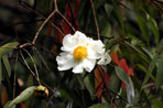
Naa නා (national tree) මල flower


Kalpitiya-ගල්පිටිය-Calpentyn-Galpatuna -a historic theater of old battles and new confrontations


(November 10, Colombo, Sri Lanka Guardian) The recent fighting along the North-western shore of Sri Lanka, extending from Mannarma (Mannar), through Meepaathota (Illuppikadavai) and Naagathudaava (Nachchikuda) to Punranna (Poornaryn), has been at the focus of the news media. However, a quiescent war has been going on around the the Kalpitiya (Kalpiddi) lagoon and extending down to Halaavatha (Chilaw). The proximity to the Wilpattu jungles has also been attractive to the LTTE which has been carrying out covert operations here. As the LTTE looses its marine bases in the Manaram coast, it will begin to set up clandestine operations further south. The coastal stretch from Halaavatha (Chilaw) to Kalpitiya is clearly an important theater of operations. About an year ago, the Navy detected two LTTE boats at Batalangam-doova near Kalpitiya, bringing in anti- air craft guns and ammunitions, steel balls etc. In July 2006 the Navy confronted a flotilla of 12 LTTE boats in Kalpitiya. There would have been many undetected LTTE operations in this region at that time. Thus LTTE activity in the Kalpitiya region had been important for quite a long time. With the gradual collapse of the LTTE sea-tiger operations along the Naagathudaava (Nachchikuda) Punranna (Poornaryn) coast, it is natural that the LTTE would seek to establish clandestine operations in the Kalpitiya region which is away from the current focus of the government forces. Just recently, a suspected LTTE operative who has been working for an NGO, as a provincial correspondent of a private TV channel has been arrested. This follows on the heels of the recent arrest of Sivalingam Thiruvelai, a woman-suicide cadre of the LTTE at Kalpitiya. Reports in the early part of the year involved the detection of claymore mines from the Kalpitiya and Chilaw area, transformer explosions in Mundalama, Kalpitiya and surrounding areas. On Sunday, 2nd November, a search operation ended up with ten suspects held for questioning. See the attached map of the Kalpitiya region.

Map of the Kalpitiya-Kudiramale coast

Kalpitiya or Galpatuna ?

Kalpitiya has an old Dutch Fort (1667), built on an older Catholic shrine. It guarded the strategic entrance to the large lagoon. The Dutch attempted to control King Rajasingha's trade with India. Maps drawn during the Dutch period gave it the name "Calpentyn". This supports the possibility that today's "Kalpitiya" was originally known as "Galpatuna" at some earlier period. The sinhala word "Patuna" has its roots in the Sanskrit and Pali words "Pakkana" and "Pattana". Thus the city of Sravasti" was known as "Dharmapattna" in the Pali Texts. The word "pattana" also occurs in the Mahabharata and is used to denote a city or a town. In sinhala it is used for coastal towns as well as interior patunas (e.g., Agaraapathana). Jambukola-Patuna, Javapatuna (Jaffna), and Gonagaamaka-pattana are well known examples of the occurance of the "patuna" place name in the early place names of Sri Lanka. The south-Indian Tamil usage of "pattinam", e.g., in Kavirapattinam, Nagapattinam etc., is mostly for coastal towns, possibly of "lower-caste" people. The usage in Tamil is more recent than the usage in the Mahabharata etc. Hence the word most likely came into Tamil from Sanskritic source languages, finally appearing in Tamil in the Chankam period. Thus, Both in Sinhala and in Tamil, the name "Gal-patuna" would make more toponymic sense than "Kalpitiya" or "Kalpiddi", as 'patuna" or "pattinam" indicates a coastal town.

Kihirikanda and other historic ports near Wilpattu.

The Wilpattu (Vilpaththu) reserve of today was, in ancient times, a region of historic hamlets linked to harbours and entrepots. A Legend has it that Kihirikanda (Kudiramalai), a point on the shore (see map), was also a landing place of Vijaya, while Kuveni lived in 'Kaalivila (Kali Villu)', in today's Wilpattu. Pointedly, Kaali" is a female demonic representation of Durga, i.e., a "Yakkha". Kihirikanda was visited by Roman sailors during the time of Claudius (417 AD), and Pliny talks of a large settlement called "Hippuros" here. "Hippo" is a stem word for horse, derived from the Indic word "Ashva" which becomes "Asva" in sinhla, in addition to the word "thuranga" and other words. Hence the modern name "Kudiramalai" may hark back to the Maalayalee stem word "Kuthira" for horse. The Malayalee word would have been introduced during the Magha Invasions, by translating an older place-name, just as in the clear case where Meepaathota (Madhupatheetha of the Mahavamsa) becomes Illupaikadavai by a direct translation in to Malayalee. Thus an older name like "Thuranga-malé may have existed, although there is no strong evidence. The name Kihirakanda may be associated with the word 'Kadira-male', since "Kadira" from Sanskrit probably refers to 'Mimosa Catechu' of the 'accacia' family. This is the 'Kihiri' tree in Sinhala, and 'Karuveal' in Tamil.

Several islands off the western shores of Sri Lanka seem to have had horses. The Delft islands (Nindundiva of the Dutch historian Baldeus, 1658) are well known for wild horses. Did some of the islands near Galpatuna or Galpitiya (Kalpitiya) have horses? Could they have existed since Roman times? Was Kalpitiya, Kudiramalai, or the islands Karadimunna (Kaaradumunai) used for exporting and importing horses? Were the islands used as temporaray locations for animals waiting to be exported or imported? We do not know for sure.

When we move to the interior, towards Wilpattu, there are stone pillars and other remnants of Buddhist ruins at Kaalivila. More ruins are found near the Kokmotte bungalow in Wilpattu; and near the Aelavuna Gala (Ochappu Kallu). A 2nd century BCE inscription is also found here. Maradan Maduva, the present Vilpaththu office area, is associated with Saaliya and Asokamaala, i.e., pertains to the time of Dutugamunu. 'Ransirimaale (Tantirimalai) is also a part of the park since 1969, and is associated with the Saliya story.

It is also associated with Sangamitta and the arrival of the Bo sapling. Ranpariththa (Pomparippu) is also in the Wilpattu region and is a part of the pre-history of the island. Clay urns dating back to the early iron age have been found here. However, no gold has been found to justify the name "Ranpariththa" or Pomparippu.
In fact, some scholars have wondered if the name Pomparippu is a corruption of "Thambraparni", a place name associated with the Vijaya legend. The golden brown colour of the sand is said to have transferred to the palms of the sailors who landed on the beach, leading to the name "Thambraparni". The "Ran" of the Ranpariththa, (or the Pom of Pomparippu) is simply the golden brown sand.

There are ancient ports at Palangathota (Palangathurai) and Kollankanatte. These ancient ports are currently theaters of war. Thus On the 25th of March 2006 an LTTE craft, disguised as a multi-day fishing trawler blew itself up destroying a naval craft off Kudiramalai (Kihirikanda), between Mannar and Kalpitiya. This was during the Cease-Fire agreement.

A number of other place names in the Kalpitiya Lagoon area are noteworthy. The two islands Maha Arakgala (Peria Arichchal) and the "sinna arichchal" seem to fit in with the names like "arangala" islands near Balapitiya, and the Ahungalle point further south. There is also a Mahisadoova, known today as "Eramaitivu". This harks back to the Mahisadoova which is north of Mannar. An interesting aspect of the Vijaya legend is the story that the boat carrying the women companions of Vijaya's men landed in "Mahisadoova". If the Vijaya legend is linked with Kihirikanda, then it is the "Mahisadoova" of Kalpitiya that becomes relevant. The existence of different versions of the legend is in keeping with many landings of immigrant groups, led by princely leaders, all resonating with a single story.

The coastal strip of the Kalpitiya lagoon has a peculiarly-named location, "Somativadi". Montmorillite or "Fullers earth", known as "Dohomaeti", may have been the source of this place name, given in our map as "Dohomaeti-vaadiya". Other place names where "Dohomaeti" (or washing clay) are referred to are discussed in our place-names website, viz., Main Page

The place name "Thelliyadda" ( Tillaiyadi in Tamil) is also articularly interesting. "Theli" is the Sinhala name for a type of Mangrove (Excoecaria agallocha) whose latex can cause blindness (varieties of Mangroves, and plants of toponymic interest are discussed at the website: Ethno-Botany. Place names like Karadiyavala (Karadipuval) are indicative of brackish water deeper inland. it is also interesting to note that the western-most coastal strip has names like Nuaricholai (Moragalla), where the name is linked to the Mora tree which is definitely a type of inland vegetation.

The special reef formations near the Kalpitiya coast, the possibilities of a recreational wonderland linking the Wilpattu forest with the underwater land of coral, are all promises that have to await the end of terrorism in Sri Lanka. Then these shores can become as famous as they were during the time of Pliny and Ptolemy.- Sri Lanka

This contribution from Prof. Chandre Dharma-wardana appeared in the Sri Lanka Guardian, 10-Nov-2008 with some changes